Map of the Highlands of Roan
Map of the Highlands of Roan
Couldn't load pickup availability
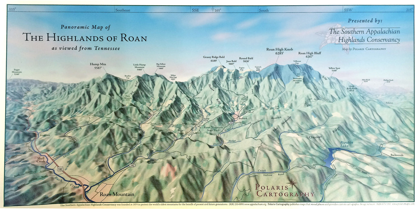
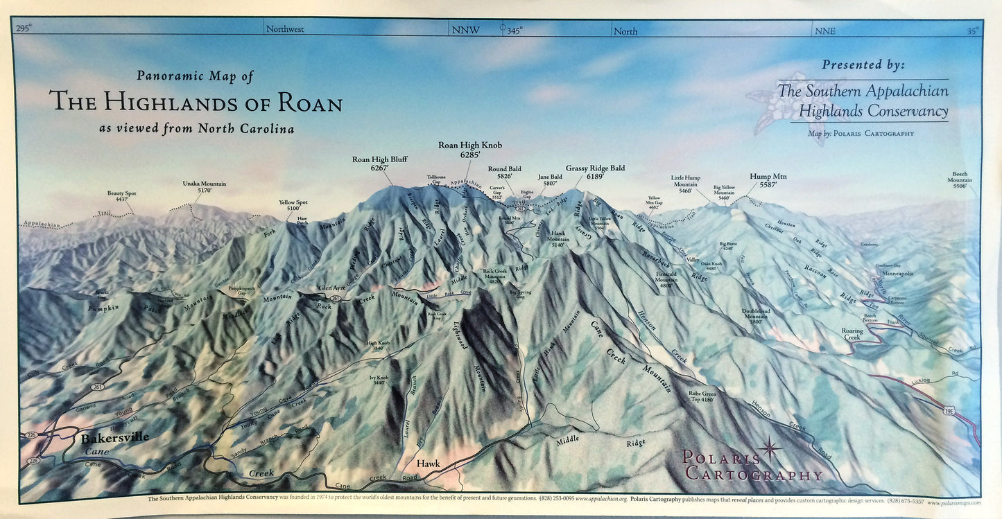
Located on the TN/NC border, the Highlands of Roan is the flagship conservation focus area of the Southern Appalachian Highlands Conservancy. Here, our founders — over 40 years ago — championed an improved route for the Appalachian Trail and began securing the scenic landscape surrounding the trail, one tract at a time. The section of the Appalachian Trail over the high elevation grassy balds of the Highlands of Roan — from Carvers' Gap to 19 E — is often touted as one of the most breathtaking portions of the entire national scenic trail. This illustrated map by Polaris Cartography shows prominent peaks along the Roan Massif with elevations, as well as towns, roads, creeks, and ridges in the vicinity.
We offer TWO separate maps — one with a view of the Roan Massif from the Tennessee side, and one as viewed from the North Carolina side.
The maps measure 23 inches wide by 12 inches high, including a white 1/2 inch border surrounding the image. They will ship in a cylindrical poster tube, and may take longer to arrive than other packages.
Share


